A few more days of beautiful fall weather are ahead before some rain and storms move in to dampen the weekend. We'll return to more pleasant fall conditions by the start of next week.
For tonight we'll be mainly clear and calm again. Lows will drop into the mid 50s.
Sunny, warm and dry conditions are back Wednesday. Afternoon highs will be in the low 80s. We'll see more of the same Thursday and Friday with cool mornings in the 50s and warm afternoons in the mid 80s.
Our next cold front will arrive this weekend. Most of Saturday will be quiet and warm. Showers and storms are expected to push in later in the evening and continue through the night before tapering off early Sunday.
A few strong storms with gusty wind are possible, but the overnight timing will likely limit any severe weather potential. Rain amounts of 1-2" look possible.
Highs Saturday will be in the mid 80s, but we'll begin to cool as we dry out by Sunday afternoon with highs in the mid 70s.
Next week brings more pleasant fall weather with highs in the 70s and lows in the 50s.
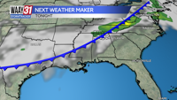
TONIGHT: Clear skies. Low temperatures in the mid-50s. Wind: NE 5 mph.┬Ā
WEDNESDAY: Sunny, warm and dry. Highs in the low 80s. Wind: N-NE 3-6 mph.