**LEVEL 1/5 SEVERE WEATHER RISK SATURDAY NIGHT**
We're keeping above average temperatures for Friday and Saturday, yet again reaching to the mid-80s at our warmest. It will be a pleasant evening for all the fans in the stands for Big Game Friday Night high school football with temperatures sitting near 80 at kickoff and dry conditions.
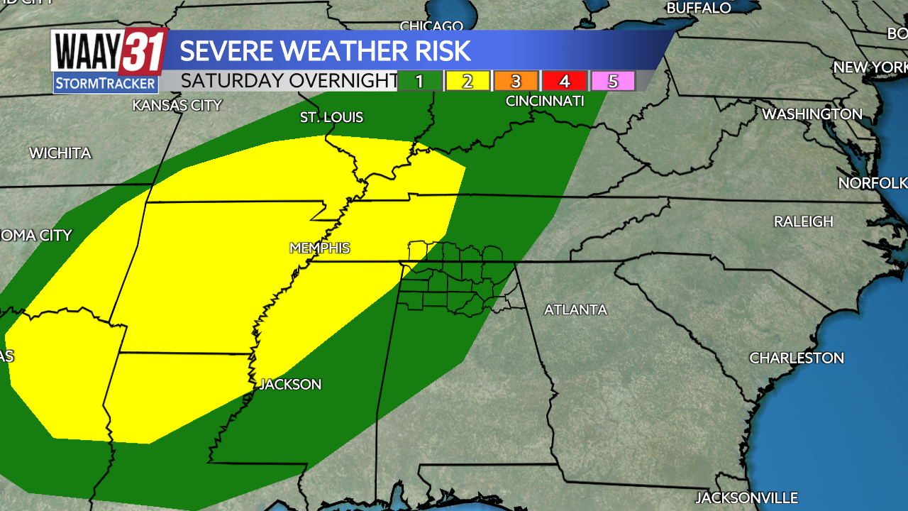
Saturday starts off mostly sunny but will see increasing cloud cover through the late afternoon and evening. Saturday, shortly after dinnertime, a cold front will move through bringing a line of heavy rain and storms to the area. North Alabama is in a level 1/5 risk for severe weather, with the greatest threat being gusty winds and brie periods of torrential rain.
The cold front and rain/storm mix will track east through the overnight hours with the lion's share of the system getting out of our way by sunrise Sunday. A few stray showers and pockets of cloud cover will remain through lunchtime.
After the rain leaves us, the cooler air from the front sticks around. Sunday's high temperature will rise to only 70, a full 15 degrees cooler than the day before. High temperatures in the low and mid-70s and wake-up temperatures in the 40s and 50s will be ours to keep for the remainder of the work-week.
FRIDAY: Sunny, above average temperatures. Highs in the mid-80s. Wind: NE 5-10 mph.
TONIGHT: Clear skies, mild. Lows in the low 60s. Wind: NE 5 mph.